Past Projects
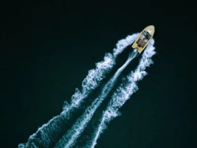
Increased boating activity may threaten or harm the municipal and domestic intakes on Kalamalka and Wood Lake. The Lake Country and Coldstream Districts, RDNO, RDCO, the Okanagan Similkameen Invasive Species Society, and the OCCP retained Ecoscape Environmental Ltd. and Larratt Aquatic Consulting Ltd. to undertake a comprehensive scientific study of the potential consequences.
OCCP is pleased to announce completion of the SHIM of Mission Creek's critical habitat area. Mapping information includes GPS and photo survey data for fish spawning areas, wetlands, and features and attributes such as retaining walls, bridges and culverts, side channels and tributaries, points of erosion, agricultural runoff, wildlife trees, and fish presence.
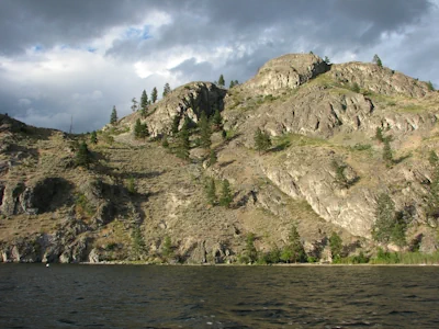
Foreshore Inventory Mapping often referred to as FIM is a geo-referenced record of the foreshore. It provides a baseline for regulatory monitoring and enforcement, future restoration, and estimating the cumulative impact of development on species such as kokanee. The data analysis involves tabulating the number of docks, shore type, land use, riparian condition, shoreline substrate composition, lakeshore structures, level disturbance and other variables for each shoreline section.
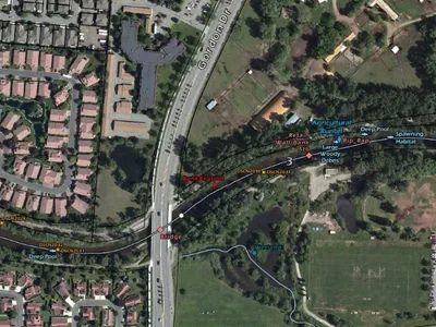
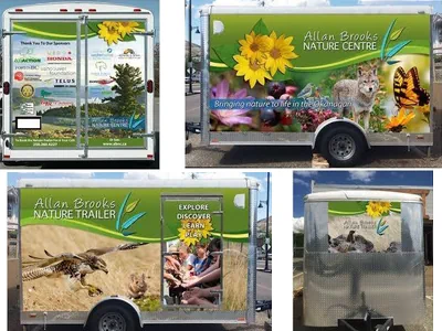
![]() This Wetland Reclamation and Interpretive Trail Project, led by the Allan Brooks Nature Centre, highlights a sensitive riparian ecosystem in North Vernon Park, which is located east of 20th Street and north of 48th Avenue (behind Rona and Walmart).
This Wetland Reclamation and Interpretive Trail Project, led by the Allan Brooks Nature Centre, highlights a sensitive riparian ecosystem in North Vernon Park, which is located east of 20th Street and north of 48th Avenue (behind Rona and Walmart).
In 2013 the Allan Brooks Nature Centre hosted a nature-themed photo contest open to all youth 14 years of age and under. The contest was opened up to adults and general public (>14 years old), once the school year was out of session.
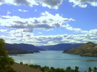
It is becoming readily apparent that increased development is degrading shoreline areas along Kalamalka and Wood lakes. These lakes are key components of recreation, tourism, and urban settlement in the area. Agriculture and transportation are other key land uses associated with the lakes.
March 2020 Note: this project was formerly known as "Biodiversity Conservation Outreach".
How Do We Get from Here to There?
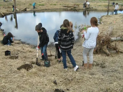
This two-year outreach and education initiative started as a collaboration between the Allan Brooks Nature Centre, the Okanagan Similkameen Stewardship Society, and OCCP. The goal was to raise awareness about local ecosystems and the Biodiversity Conservation Strategy for the Okanagan Region and to engage community members in habitat restoration.
As the project developed, many other partners joined the initiative and developed two travelling public outreach exhibits and coordinated six community stewardship events to restore natural habitat. Over 74,000 people in the Okanagan region saw the exhibit promoting ways to work together for “Protecting Habitat Connectivity and Promoting Stewardship”.
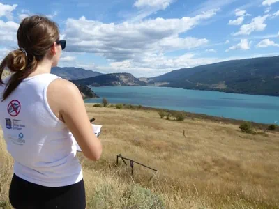
OCCP is working in collaboration with RDCO, RDNO, and the Districts of Coldstream and Lake Country and the Okanagan Similkameen Evasive Species Society (OSESS) to investigate the long-term potential threats of boating activity on lake water source protection for the municipal and domestic intakes on Wood Lake and Kalamalka Lake.
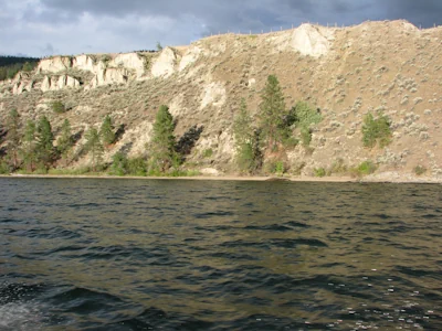
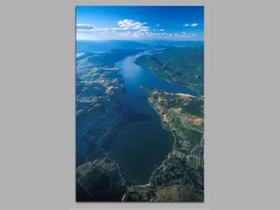
Foreshore Inventory and Mapping (FIM) is a method of collecting information on the current state of the foreshore, or shoreline, of a lake. The most recent FIM survey report (2016) provides an updated summary of the condition of the Okanagan Lake shoreline, and compares the 2016 landscape with earlier data to allow the research team to measure the environmental impacts that accumulate from lakeshore development over time.
This workshop will provide an overview of the opportunities and challenges of planning to maintain environmental integrity. Speakers will review case studies that highlight the current legislative landscape surrounding different aspects of environmental protection, and outline guidelines, best practices, and tools available for local governments to enhance environmental protection. We will offer participants the opportunity to tackle top challenges with your peers and exchange ideas and strategies on how to enhance environmental protection.