Rapid development in the Okanagan Valley has increasingly fragmented low-elevation ecosystems, threatening wildlife movement. To address this, a collaborative project has been developed by local governments and provincial agencies, conservation organizations, and the Okanagan Nation Alliance to protect a key ecological corridor in the Central Okanagan. This project focuses on a 65km by 1km corridor linking Okanagan Mountain and Kalamalka Lake Provincial Parks, connecting essential grassland and ponderosa pine ecosystems and critical wildlife habitat.
Collaborative Input and Knowledge Gathering
The initial project focused on digital mapping and modeling to identify likely paths for primary wildlife movement in the Central Okanagan. This collaborative work was undertaken by the Regional District of Central Okanagan (RDCO), UBC, and OCCP, and identified key ecosystem corridors for conservation and restoration.
Building on the corridor mapping and modeling, OCCP hosted ten workshops with 52 individuals from 30 organizations to inform the necessary steps and guidelines for corridor preservation. These workshops explored key strategies for corridor protection, including land securement, land use planning, stewardship, restoration, nature-friendly agriculture, and research needs. Participants shared valuable insights, identified critical information gaps.
A cultural researcher from the Okanagan Nation Alliance also conducted interviews with hunters and community members of Westbank First Nation and Okanagan Indian Band to gain a better understanding of the movement of wildlife and areas for gathering plants and medicines along the corridor. The information gathered was drawn from personal experience and was place based and provided important information on the changes that have taken place on the land over time and have been passed down from generation to generation.
A Plan for Action: Connecting and Protecting
These collaborative efforts culminated in the development of the Okanagan Mountain-K’nmalka Wildlife Corridor Action Plan, released in fall 2023. The plan outlines 15 sets of actions to protect and connect wildlife, habitats, and biodiversity between the Okanagan Mountain and Kalamalka Lake provincial parks. The actions support wildlife migration, maintain genetic diversity, boost ecosystem resilience, enhance food security, and help species adapt to a changing climate.
The project supports and expands upon the Regional District of the Central Okanagan (RDCO) initiative to plan for ecosystem connectivity in the Central Okanagan, which is detailed in the "Planning for Ecosystem Connectivity Workshop Report" [PDF]. It also connects with two cross-border ecological corridor projects: the Yellowstone to Yukon Conservation Initiative and the Sagelands Heritage Program by Conservation Northwest.
The Action Plan will serve as a template for other corridors yet to be established across public and private lands in the RDCO and areas adjacent jurisdictions. Moving forward, OCCP is working to expand the focus of this ecosystem connectivity project from the central Okanagan to the north, south and beyond.
Why Ecosystem Connectivity Matters
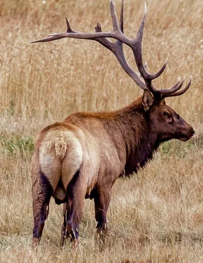
Ecosystem connectivity is the interconnected network of habitat patches and migration corridors essential for species survival. It provides space for:
- Species migration
- Hunting and foraging
- Shelter
- Access to larger breeding populations and greater genetic diversity
Protecting connectivity also helps conserve at-risk species and reduce human-wildlife conflict. Furthermore, it supports essential ecosystem functions that, in turn, provide food, air, and water for human populations and moderates the impacts of climate change by:
- Reducing groundwater evaporation and soil loss
- Providing flood control areas
- Providing a natural buffer for wildfires
Connectivity strategies use ecosystem patches linked by landscape and linear corridors, sometimes with buffer zones. Where full corridors aren't feasible, small "stepping stone" patches can provide connectivity for some species.
Timeline
- 2012-2014
- OCCP Partners prepare plans and guidelines for corridors and ecosystem connectivity, incorporated into the “Designing and Implementing Ecosystem Connectivity in the Okanagan" document.
- 2015-2016
-
Working with RDCO, Dr. Lael Parrott and a graduate team from UBCO, likely paths for primary wildlife movement through the Okanagan region are identified via digital mapping and modeling.
An advisory team of government representatives and NGOs identifies opportunities for, and barriers to the proposed corridors and prioritizes corridors for protection.
- 2017-2018
-
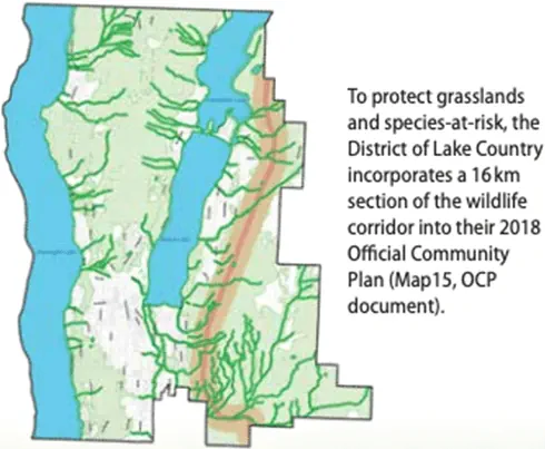
Source: District of Lake Country Official Community Plan OCCP, UBC and RDCO work with the District of Lake Country to design environmental development guidelines and corridor mapping for their Official Community Plan (OCP).
The District of Lake Country officially adopts policies to protect the northern 16km of the wildlife corridor in their OCP.
- 2019-2022
-
A 20-person advisory team facilitated by OCCP is established to develop mapping, land use guidelines and stewardship activities for protecting the corridor across public and private lands in the City of Kelowna through their 2040 OCP.
An additional secondary corridor connecting Knox Mountain to the main corridor through Glenmore highlands is also included in the OCP.

Source: District of Lake Country Official Community Plan - 2023
-
The Okanagan Mountain Kalamalka Wildlife Corridor Action Plan is finalized in partnership with Okanagan Nation Alliance.
The Action Plan is designed to maintain, protect and restore the 65 km-long ecological corridor between Okanagan Mountain Provincial Park and K’nmalka area, the last remaining connected low elevation route for wildlife movement on the east side of Okanagan Lake.
The Plan provides a set of 15 actions to connect and protect natural areas for tmixʷ (all living things) using the corridor. It centres Syilx principles, while also supporting stewardship efforts of farmers and ranchers, and providing education opportunities on the importance of habitat connectivity.
- 2024
-
Parks Canada releases a map of National Priority Areas for Ecological Corridors (NPAECs), identifying key areas across Canada where maintaining or restoring connectivity is crucial for biodiversity conservation and climate change adaptation.

Source: District of Lake Country Official Community Plan The Province of BC establishes a Habitat Connectivity Team.
- 2025
- OCCP works with partners to expand connectivity work north and south of the Okanagan and beyond.
See the Wildlife Corridor Action Plan [PDF 15.7MB, 36 pages — opens new tab]