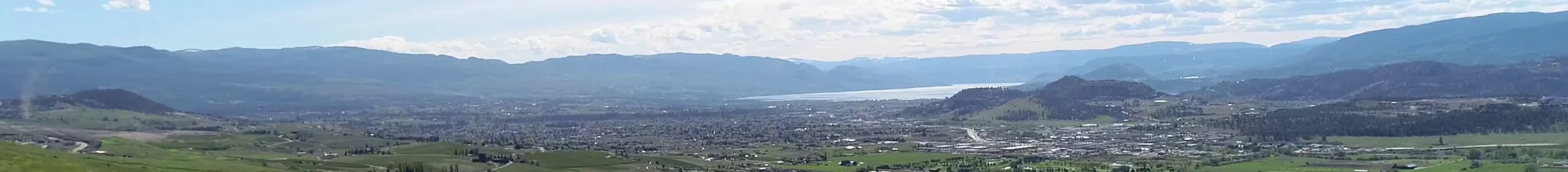
With the increasing risk of extreme weather events such as flooding, severe drought, and forest fires, innovative technologies are being used to support planning and preparedness efforts locally. LiDAR is one of the innovative technologies being employed by government, conservation organizations, and academia to support climate change resilience and biodiversity conservation efforts.
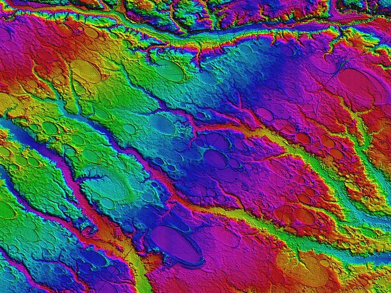
"LiDAR, which stands for Light Detection and Ranging, is a remote sensing method that uses light in the form of a pulsed laser to measure ranges (variable distances) to the Earth. These light pulses—combined with other data recorded by the airborne system— generate precise, three-dimensional information about the shape of the Earth and its surface characteristics."- National Ocean Services
LiDAR is one of the quickest and most accurate methods to produce Digital Elevation Models. It is used to enhance planning and management in many sectors including:
- Flood Modelling & Shoreline Management
- Agriculture Management
- Biodiversity Conservation
- Forest Planning and Management & Forest Fire Management
- Tourism and Park Management
- Renewable Energy Infrastructure
In the Okanagan, LiDAR is providing accurate surface models of rivers and lakes to assist with flood planning, fire departments are identifying high risk fire areas with fuel mapping, and the forest industry is using it to measure the vertical structure and density of forest canopies for enhanced management strategies.
Join OCCP and the Okanagan Basin Water Board’s (OBWB) Water Stewardship Council, on March 4, 2019, as we explore the innovative uses of LiDAR. This free half day session will provide detailed information on the innovative ways LiDAR is improving the way we plan and manage industry and government sectors.
OBWB’s Executive Director, Anna Warwick Sears, will facilitate the discussions and the agenda includes:
- Introduction to the Okanagan Watershed LiDAR Project - Anna Warwick Sears, Executive Director OBWB
- Innovative Uses of LiDAR for Local Government and Forestry - Cam Brown, Forsite Resource Management
- Opportunities to Apply New Okanagan LiDAR Data - Mathieu Bourbonnais, Assistant Professor, UBCO
- LiDAR Case Studies - Jason Schleppe, Senior Natural Resources Biologist, Ecoscape Environmental Consulting; others
For more information and to register click here.
"Innovations such as LiDAR and collaboration are key elements in supporting successful biodiversity conservation and climate change resilience in the Okanagan." – Scott Boswell, OCCP Program Manager